Description
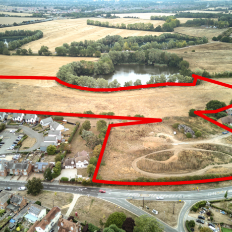
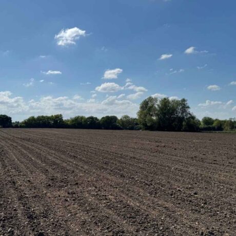
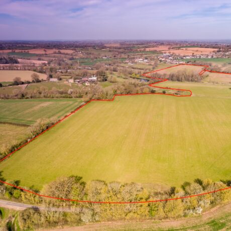
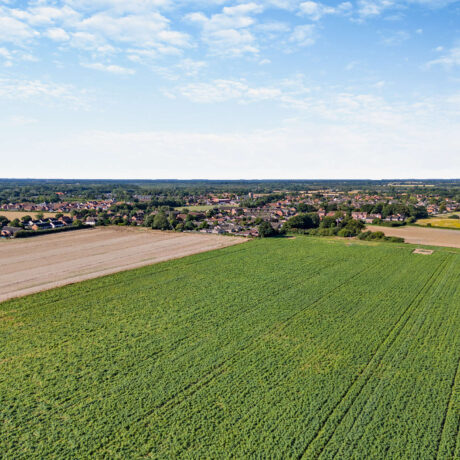
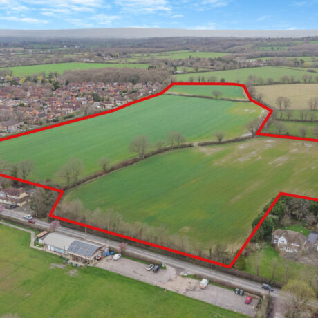
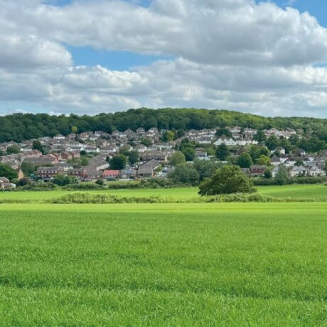
A strategically located block of predominately Grade 2 arable land and farm buildings on the edge of King’s Lynn, with significant development potential including about 35.48 acres of allocated employment land and further scope for renewable energy schemes.
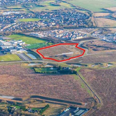
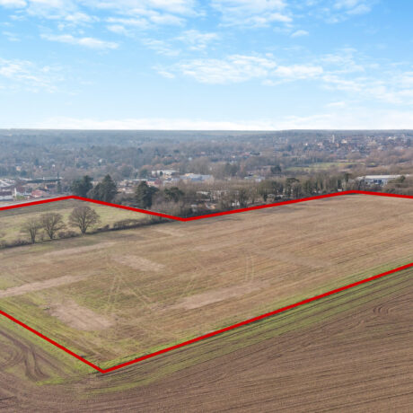
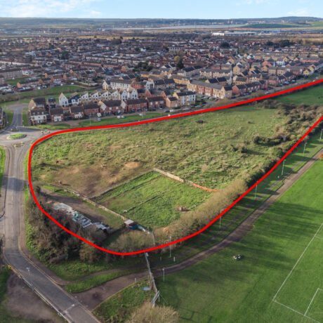
LOT 1 – 35.48 acres (14.36 hectares) of allocated land for employment use
Guide Price £710,000
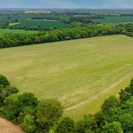
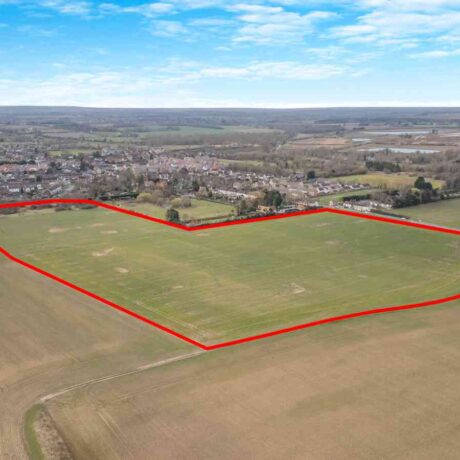
LOT 2 – 270.08 acres (109.31hectares) of arable land and farm buildings at White House Farm
Guide Price £2,290,000
In all, about 305 acres (123.44 hectares).
Offers in the region of £3,000,000
The property is offered for sale by Private Treaty as a whole or in up to two lots.
Planning
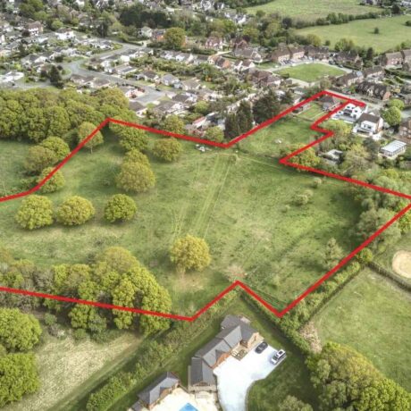
The land falls outside the defined settlement boundary of King’s Lynn. Approximately 35 acres is allocated for employment use (E1.12‑SAD) in the adopted King’s Lynn & West Norfolk Local Plan (March 2025), providing clear short-term commercial development potential compatible with the adjoining Saddlebow Industrial Estate, subject to obtaining the necessary consents.
It is also considered that the land between the River Nar and the railway line (OS 1244) and the land south of Hamlin Way (OS 4342) offer short to medium‑term potential for commercial development, being well aligned with and compatible with the adjoining employment and industrial uses.
Given the environmental designations and flat topography, the land at the southern end of the property is considered to hold medium to longer-term potential for renewable energy schemes.
A planning brief is available from the Vendor’s agent.
Cropping Schedule

Lot 1: Allocated Land
About 35.48 acres (14.36 hectares)
Lot 1 comprises approximately 34.81 acres (14.01 hectares) of Grade 2 arable land immediately adjoining the established Saddlebow Industrial Estate on the southern edge of King’s Lynn.
The land is allocated for employment use (E1.12‑SAD) in the adopted King’s Lynn & West Norfolk Local Plan (March 2025) and is considered to offer strong short to medium‑term potential for commercial development compatible with the surrounding industrial and logistics uses.
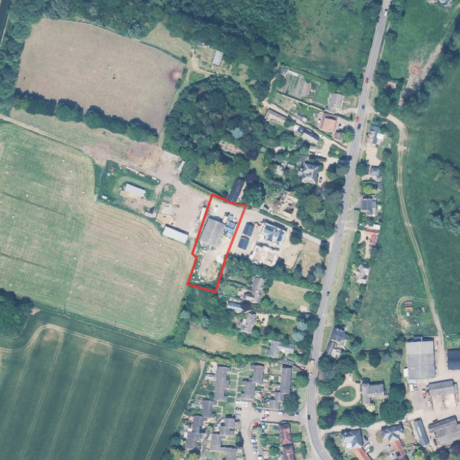
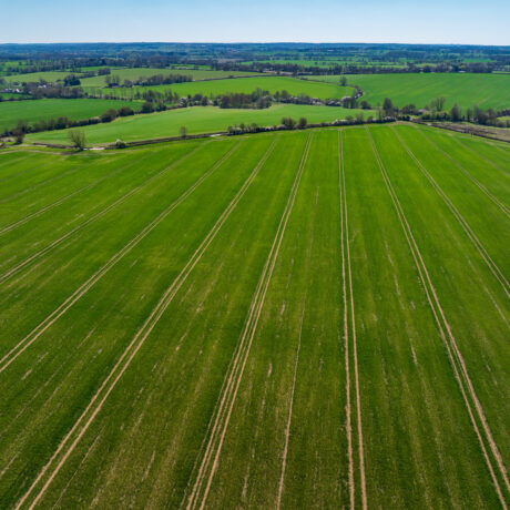
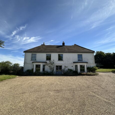
Lot 2: Arable Land & Farm Buildings
About 270.08 acres (109.31 hectares)
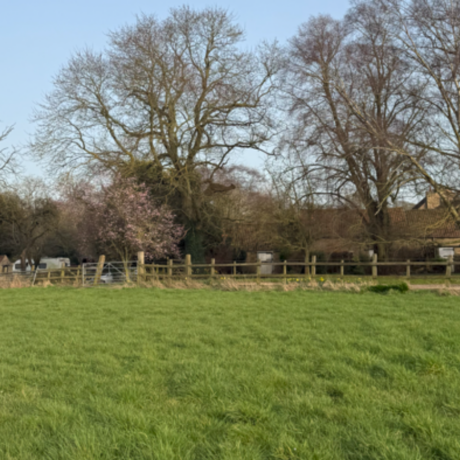
A substantial block of land with about 261.86 acres (105.97 hectares) of farmland largely classified as Grade 2 with some Grade 3 by DEFRA and described as the Blacktoft soil series of England and Wales – deep, stoneless, permeable calcareous silty soils with good drainage, well suited to combinable and root cropping. The land is farmed in hand by the Vendor within a rotation of combinable crops and sugar beet.
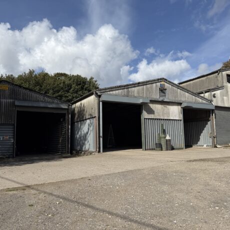
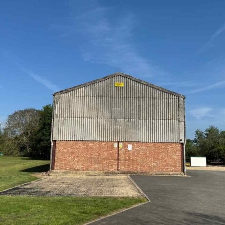
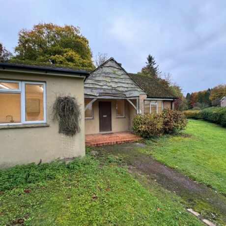
The farm buildings are situated at the centre of the property and comprise:
- A traditional brick building with cement fibre roof and lean to extensions on either side (approximately 26.50m x 9.50m), currently used for general storage purposes.
- A steel portal framed Dutch barn with cement fibre roof (approximately 18.00m x 12.00m) historically used for storing sugar beet and farm machinery.
The buildings offer potential for alternative uses, subject to obtaining the necessary planning consents. Further details are available from the Vendor’s agents.
Tenure
The property is for sale freehold with vacant possession upon completion. The property is registered under Land Registry title numbers NK189499 and NK327532.
Overage
All of the land is subject to an existing overage clause in favour of a third party, reserving 15% of any uplift in value arising from any planning permission for non-agricultural or horticultural use, which expires in March 2031.
Lot 2 will be sold subject to an additional overage agreement to benefit the Vendor and any beneficiaries or successors in title, under which the Vendor will retain a 30% share of the net increase in value of the property arising from any planning permission for non-agricultural or horticultural use for a period of 40 years.
Further details are available from the Vendor’s agents.
Ingoing Valuation
The Purchaser will, in addition to the purchase price, be required to take over and pay for all growing crops, cultivations, fertilisers, sprays, and acts of husbandry at valuation to be agreed between the parties. The valuation will be based on the cost of establishing the crops, including cultivations, seed, fertilisers, sprays, and other inputs, plus a reasonable profit or management allowance, all assessed in line with current agricultural industry standards and contractor rates.
Payment will be due immediately upon agreement of the valuation with interest at 4% above Barclays Bank base rate from exchange of contracts until payment. Should the valuation not be agreed within four weeks of exchange of contracts, the matter will be referred to a single arbitrator appointed by mutual agreement or, in default, by the President of the Royal Institution of Chartered Surveyors.
Environmental Schemes
The land is subject to two Sustainable Farming Incentive (SFI) agreements (1680796 & 1969585) expiring on 28th February 2027 and 31st January 2028. Further details are available from the Vendor’s agent.
Sporting, Timber & Mineral Rights
All sporting, timber and mineral rights are included in the sale insofar as they are owned. Mineral rights are reserved by a third party over approximately 0.81 acres (OS1870), being a small section of disused railway. The existing reservation does not grant any rights of access, entry, or mineral extraction. The remainder of the farm is free from any such reservations. Further details are available from the Vendor’s agent.
Easements, Wayleaves & Rights Of Way
The property is sold subject to and with the benefit of all rights including rights of way, whether public or private, light, support, drainage, water and electricity supplies and any other rights and obligations, easements and quasi-easements, restrictive covenants, and all existing and proposed wayleaves for masts, pylons, stays, cables, drains, water and gas and other pipes, whether referred to in these particulars or not.
Boundaries
All boundaries outlined on the attached plans are for identification purposes only. Potential buyers are responsible for confirming the boundaries.
Any mistakes, omissions, or inaccuracies will not allow the buyer to cancel the contract or claim compensation.
Local Authority
Borough Council of King’s Lynn & West Norfolk
Address: King’s Court, Chapel Street, King’s Lynn, Norfolk, PE30 1EX
Tel: 01553 616200
Website: www.west-norfolk.gov.uk
Viewings
Strictly by appointment with the selling agents. Interested parties are requested to contact the agents to arrange a viewing.
VAT
Should any sale of the property or any rights attached to it become chargeable for the purpose of VAT, such tax will be payable by the purchaser in addition to the purchase price. All interested parties are advised to seek independent professional advice regarding their VAT position.
Anti-Money Laundering
In accordance with the Money Laundering Regulations 2017, once an offer is accepted, the purchaser(s) must provide any requested information to complete the necessary due diligence as a legal requirement.
Health & Safety
Given the potential hazards of a working farm, we ask that you exercise caution when viewing the property. Neither the seller nor the selling agents are responsible for the safety of those viewing the property, and accordingly, those viewing the property do so at their own risk.


 " alt="">